This story was originally published by Yale Environment 360 and is reproduced here as part of the Climate Desk collaboration.
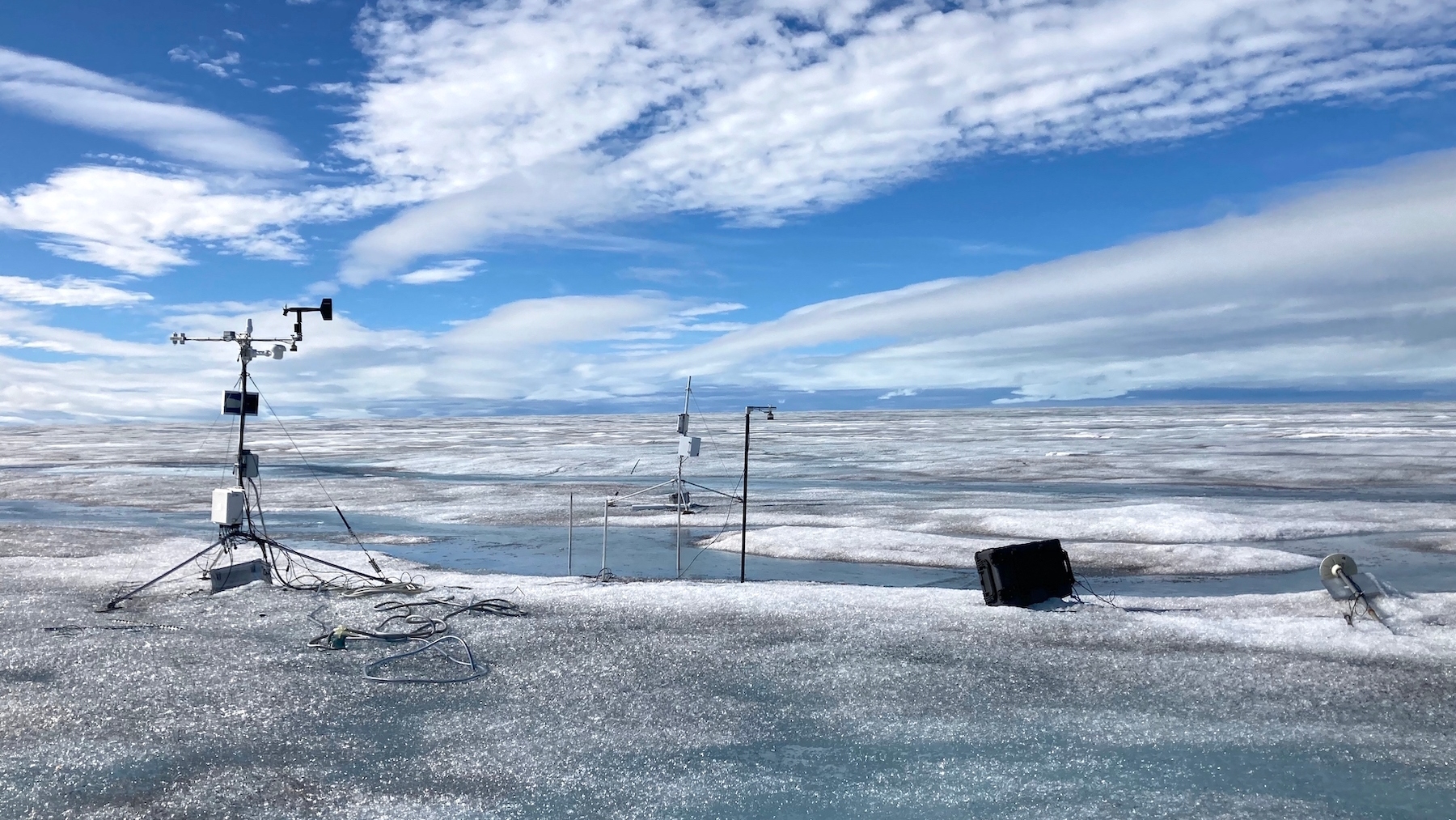
In August 2021, rain fell atop the 10,551-foot summit of the Greenland ice cap, triggering an epic meltdown and a more than 2,000-foot retreat of the snow line. The unprecedented event reminded Joel Harper, a University of Montana glaciologist who works on the Greenland ice sheet, of a strange anomaly in his data, one that suggested that in 2008 it might have rained much later in the season — in the fall, when the region is typically in deep freeze and dark for almost 24 hours a day.
When Harper and his colleagues closely examined the measurements they’d collected from sensors on the ice sheet those many years ago, they were astonished. Not only had it rained, but it had rained for four days as the air temperature rose by 30 degrees Celsius (54 degrees Fahrenheit), close to and above the freezing point. It had warmed the summit’s firn layer — snow that is in transition to becoming ice — by between 11 and 42 degrees F (6 and 23 degrees C). The rainwater and surface melt that followed penetrated the firn by as much as 20 feet before refreezing, creating a barrier that would alter the flow of meltwater the following year.
All that rain is significant because the melting of the Greenland ice sheet — like the melting of other glaciers around the world — is one of the most important drivers of sea level rise. Each time a rain-on-snow event happens, says Harper, the structure of the firn layer is altered, and it becomes a bit more susceptible to impacts from the next melting event. “It suggests that only a minor increase in frequency and intensity of similar rain-on-snow events in the future will have an outsized impact,” he says.
Rain used to be rare in most parts of the Arctic: The polar regions were, and still are, usually too cold and dry for clouds to form and absorb moisture. When precipitation did occur, it most often came as snow.
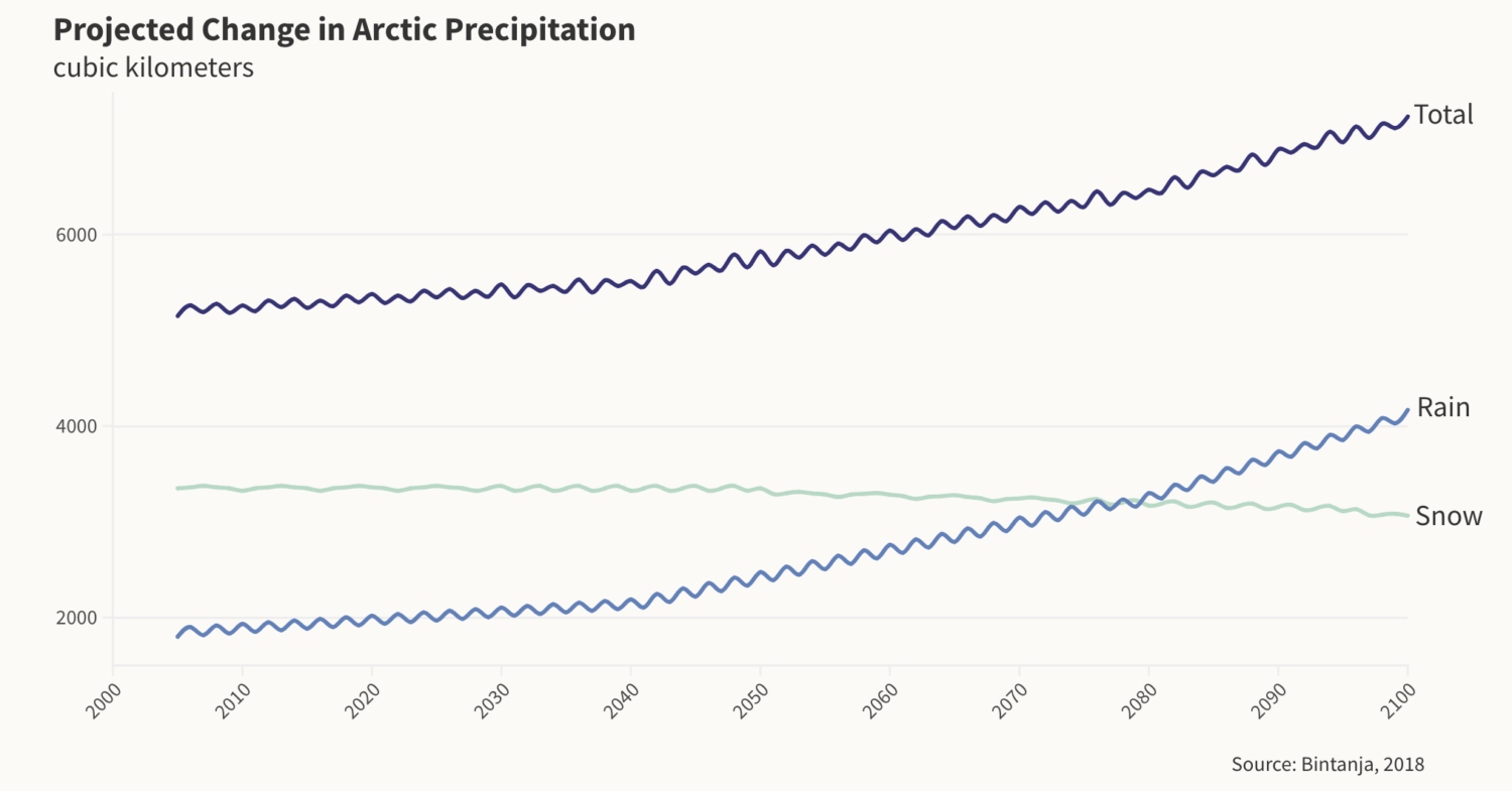
Twenty years ago, annual precipitation in the Arctic ranged from about 10 inches in southern areas to as few as 2 inches or less in the far north. But as Arctic temperatures continue to warm three times faster than the planet as a whole, melting sea ice and more open water will, according to a recent study, bring up to 60 percent more precipitation in coming decades, with more rain falling than snow in many places.

Such changes will have a profound impact on sea ice, glaciers, and Greenland’s ice cap — which are already melting at record rates, according to Mark Serreze, director of the National Snow and Ice Data Center at the University of Colorado. The precipitation will trigger more flooding; an acceleration in permafrost thaw; profound changes to water quality; more landslides and snow avalanches; more misery for Arctic animals, many of which are already in precipitous decline due to the shifting climate; and serious challenges for the Indigenous peoples who depend on those animals.
Changes can already be seen. Thunderstorms are now spawning in places where they have historically been rare. In 2022, the longest thunderstorm in the history of Arctic observation was recorded in Siberia. The storm lasted nearly an hour, twice as long as typical thunderstorms in the south. Just a few days earlier, a series of three thunderstorms had passed through a part of Alaska that rarely experiences them.
Surface crevassing, which allows water to enter into the interior of the icecap, is accelerating, thanks to rapid melting. And slush avalanches, which mobilize large volumes of water-saturated snow, are becoming common: In 2016, a rain-on-snow event triggered 800 slush avalanches in western Greenland.
Rick Thoman, a climate scientist at the University of Alaska Fairbanks, says that rainfall at any time of year has increased 17 percent in the state over the past half century, triggering floods that have closed roads and landslides that, in one case, sent 180 million tons of rock into a narrow fjord, generating a tsunami that reached 633 feet high — one of the highest tsunamis ever recorded worldwide.
But winter rain events are also on the rise. Where Fairbanks used to see rain on snow about two or three times a decade, Thoman says, it now occurs at least once in most winters. That’s a problem for local drivers because, with little solar heating, ice that forms on roads from November rains typically remains until spring.

The science of both rain and rain-on-snow events in the Arctic is in its infancy, and it is complicated by the fact that satellites and automated weather stations have a difficult time differentiating between snow and rain, and because there are not enough scientists on the ground to evaluate firsthand what happens when rain falls on snow, says Serreze.
It was hunters who first reported, in 2003, that an estimated 20,000 muskoxen had starved to death on Banks Island, in Canada’s High Arctic, following an October rain-on-snow event. It happened again in the winters of 2013-2014 and 2020-2021, when tens of thousands of reindeer died on Siberia’s Yamal Peninsula.
In both places, the rain had hardened the snow and, in some places, produced ice, which made it almost impossible for the animals to dig down and reach the lichen, sedges, and other plants they need to survive the long winter.
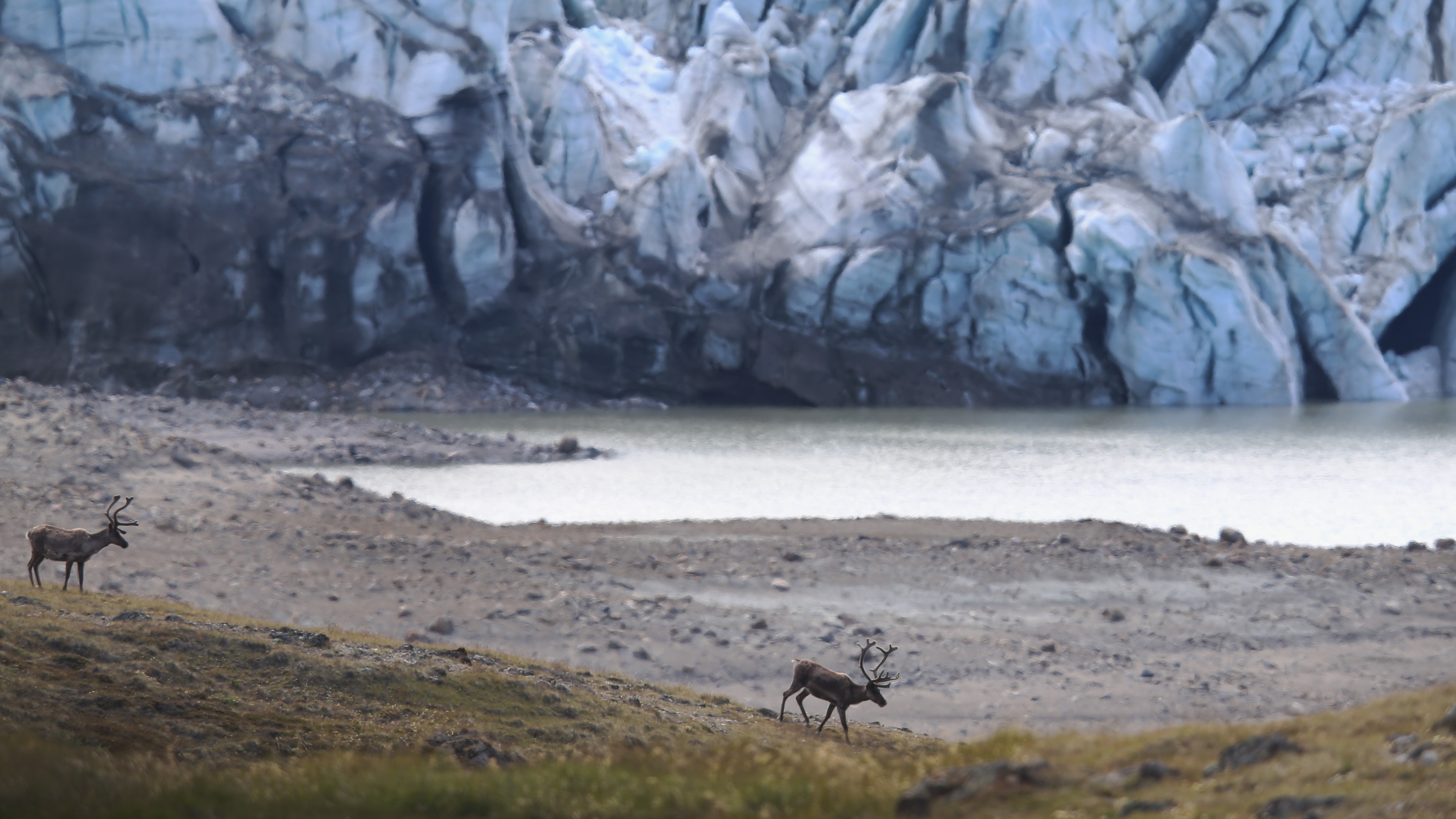
Kyle Joly, a wildlife biologist with the U.S. National Park Service, views an increase in rain-on-snow events as yet another serious challenge for the world’s 2.4 million caribou, which have been in rapid decline pretty much everywhere over the past three generations. The ebbing numbers are a huge concern for northern Indigenous peoples who rely on caribou for food. Public health experts fear that Indigenous health will be seriously compromised if the animals can no longer be hunted.
Alaska’s western Arctic herd, which has been, at times, the largest in North America, had 490,000 animals in 2003 but just 152,000 in 2023. But at least that herd can still be hunted. In Canada’s central Arctic, the Bathurst herd has plummeted from roughly 470,000 animals in the 1980s to just 6,240 animals today; hunting those caribou in the Northwest Territories is currently banned.
Caribou are highly adaptable to extreme environmental variability, and their numbers can rise and fall for several reasons, according to Joly. The proliferation of biting flies in a warming climate can sap their energy, as can migration detours forced by the spread of roads and industrial development, and an increase in dumps of deep, soft snow, which are linked to the loss of sea ice. (An ice-free ocean surface increases humidity near the surface, which leads to more moisture in the atmosphere.)
Sharp-edged ice and crusty snow can also lacerate caribous’ legs, and rain on snow has periodically affected some of Alaska’s 32 caribou herds. For example, the day after Christmas in 2021, temperatures rose to more than 60 degrees F (15 degrees C) during a storm that dropped an inch of rain over a large area of the state. Alaska’s Fish and Game Department estimated that 40 percent of the moose, caribou, and sheep in the state’s interior perished that winter because they could not dig through the hard snow and ice.
It’s not just caribou and muskoxen that are being threatened. There is growing evidence that rain falling in parts of the Arctic where precipitation usually arrives as snow is killing peregrine falcon chicks, which have only downy feathers to protect them from the cold. Once water soaks their down, the chicks succumb to hypothermia.
Few scientists have evaluated the hydrological and geochemical impact of rain-on-snow events in polar desert regions, which are underlain by permafrost and receive very little snow in winter. Recent studies published by Queen’s University scientist Melissa Lafrenière and colleagues from several universities in Canada and the United States point to a worrisome picture unfolding at the Cape Bounty Arctic Watershed Observatory on Melville Island, in Canada’s High Arctic, which has been in operation since 2003.
A shift from runoff dominated by snowmelt in spring and summer to runoff from both rain and snowmelt is accelerating permafrost thaw and ground slumping, and it’s filling fish-bearing lakes with sediments. One study found a fiftyfold increase in turbidity in one lake that led to a rise in mercury and a decrease in the health of Arctic char, a fish that the Inuit of the Arctic rely on.
Lafrenière says that with only 20 years of measurement, it’s difficult to point conclusively to a trend. “But we have been seeing more rain falling in bigger events, in late summer especially. In 2022, we had unusually heavy rain that dropped an average summer’s worth of rain in less than 48 hours.”
To help scientists and decision-makers better understand the impacts of what is happening, Serreze and his colleagues have created a database of all known rain-on-snow events across the Arctic. And increasingly, scientists like Robert Way of Queen’s University in Canada are working with the Inuit and other northern Indigenous peoples to ground-truth what they think the satellites and automated weather stations are telling them and to share the data that they are collecting and evaluating.
Way, who is of Inuit descent, was a young man when he witnessed parts of the George River herd, one of the world’s largest caribou herds, migrate across the ice in central Labrador. “There were thousands and thousands and thousands of them,” he recalls with wonder. The herd contained 750,000 animals in the 1980s; today, it has no more than 20,000. The animals are facing the same climate change challenges that caribou everywhere are facing.
Way is working with Labrador’s Inuit to better understand how these weather events will affect caribou and food security, as well as their own travel on snow and ice. But, he says, “It’s increasingly difficult to do this research in Canada because half of the weather stations have been shut down” due to federal budget cuts. Most of the manually operated stations, Way adds, “are being replaced by automated ones that produce data that makes it hard for scientists to determine whether it is raining or snowing when temperatures hover around the freezing mark.”
To better understand how rain-on-snow events are affecting the Arctic, Serreze says, researchers need to better understand how often and where these events occur, and what impact they have on the land- and seascape. “Satellite data and weather models can reveal some of these events, but these tools are imperfect,” he says. “To validate what is happening at the surface and the impacts of these events on reindeer, caribou, and musk oxen requires people on the ground. And we don’t have enough people on the ground.” Researchers need to work with Indigenous peoples “who are directly dealing with the effects of rain on snow,” he noted.
In 2007, Serreze stated in a University of Colorado Boulder study that the Arctic may have reached a climate change tipping point that could trigger a cascade of events. More rain than snow falling in the Arctic is one such event, and he expects more surprises to come. “We are trying to keep up with what is going on,” he says, “but we keep getting surprised.”


