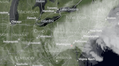
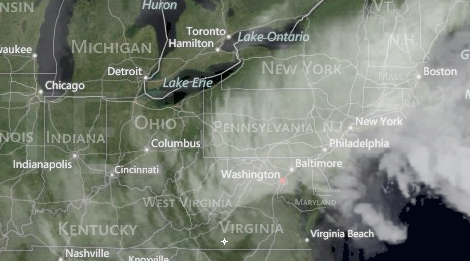
At noon today, for the second time in two weeks, New York City parks will close to visitors. And again, for the second time in two weeks, it’s because a major storm is headed to the East Coast.
We mentioned this imminent storm last week, but we didn’t mention the cool part: The storm is now known as Athena. Athena was the ancient Greek goddess of a lot of things — wisdom, civilization — but she was also goddess of war, which seems the most pertinent here. Just war, in theory, but that’s not very scary — and intimidation is a key reason the storm has a name at all.
The Weather Channel announced earlier this year that they planned to start naming these winter storms in an effort to convey the potential effects a major storm can have. Athena, in their estimation, warrants the attention — mostly because the targeted region is still recovering from Sandy. From Weather.com:
Up to six inches of snowfall combined with winds gusting over 35 mph at times across portions of Eastern Pennsylvania and interior New Jersey, which is still undergoing extensive recovery efforts from Sandy. There is the outside chance of snowfall totals approaching the 10-inch range if precipitation changes over to snowfall earlier. The combination of snow, sleet and freezing rain is expected for Interior New England Wednesday evening and overnight. The main reason for naming the storm is due to additional post-Sandy impacts.
Athena, Handmaiden to Terror, is actually a weaker storm than predicted last week. But it’s hitting an area that itself is far weaker than 10 days ago.
As with Sandy, the main concerns are wind and flooding, storm surge. From the Weather Underground:
A storm surge of 2 – 3.5′ is likely along the section of coast most heavily damaged by Sandy’s storm surge, and battering waves up to 20′ high will cause moderate beach erosion along much of the New Jersey and New York shoreline. The storm surge will cause minor to moderate flooding during this afternoon’s high tide cycle near 1 pm EST, and again at the next high tide, near 1 am EST Thursday morning. Fortunately, the high tides this week will be some of the lowest of the month, since we are midway between the new moon and full moon. Wind gusts from Athena will likely reach 50 mph along the coasts of New Jersey and Southern Long Island, NY, and could hit 60 mph on Cape Cod, Massachusetts.
The National Oceanic and Atmospheric Administration suggests you “Know the Dangers of Nor’easters,” which seems like good advice. Particularly when they are named for mythologically devastating war goddesses.
Or maybe Athena will lay down a devastating blast of wisdom. That could actually be nice.
Update: One not-nice side effect of Athena: FEMA will halt efforts to help those displaced by Sandy. From DNAInfo:
FEMA disaster recovery centers in Hurricane Sandy-ravaged sections of the city that were supposed to provide assistance to hurricane victims went MIA Wednesday morning, posting signs saying that they were closed due to the approaching Nor’easter.
The temporary shuttering of the facilities, which help victims register for disaster relief, as well as city food distribution centers come even as many of those still reeling from the monster storm were not told that they had to leave the battered areas.
Heckuva job, FEMA.


