WikipediaWreckage from the 1900 Galveston hurricane floats offshore.
On Sept. 4, 1900, the U.S. Weather Bureau office in Galveston, Texas, learned of a major storm in Cuba. It was hard to predict where it might head next; they apparently thought it was likely to head northeast. It didn’t. On the 8th, a hurricane leveled the city.
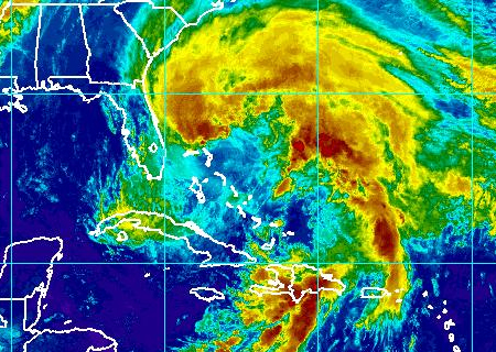
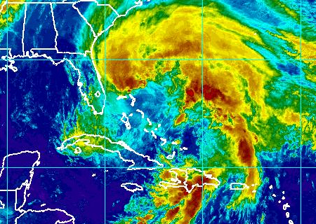
The Galveston Weather Bureau staff didn’t have much choice but to guess. As we’ve seen with Sandy over the past few days, the path of a hurricane is hard to predict even with modern sensor technology and satellites. Without the data we now collect, almost as blind as Texans in 1900.
And now the bad news: Obsolescence and budget cuts may mean that we’re about to lose some of those data-collecting satellites. From The New York Times:
The endangered satellites fly pole-to-pole orbits and cross the Equator in the afternoon, scanning the whole planet one strip at a time. Along with orbiters on other timetables, they are among the most effective tools used to pin down the paths of major storms around five days ahead.
All this week, forecasters have been relying on just such satellite observations for almost all of the data needed to narrow down what were at first widely divergent computer models of what Hurricane Sandy would do next: explode against the coast, or veer away into the open ocean?
Experiments show that without this kind of satellite data, forecasters would have underestimated by half the massive snowfall that hit Washington in the 2010 blizzard nicknamed “Snowmageddon.”
The more data, the more predictions can be made. As noted above, path isn’t the only important issue. There’s strength, ocean temperatures, and other contributing weather patterns like those making Sandy so scary.
How’d we get to this state? As we’ve noted before: mismanagement, starting a decade ago.
This summer, three independent reviews — by the Commerce inspector general, the Government Accountability Office, and a blue-ribbon team of outside experts — each questioned the government’s cost estimates for the program, criticized the program’s managers for not pinning down the designs and called for urgent remedies. The project is run by Commerce’s National Oceanic and Atmospheric Agency, along with NASA. …
In response, top Commerce and NOAA officials on Sept. 18 ordered what they called an urgent restructuring — just the latest overhaul of a program that has been troubled for many years.
Last year, the NOAA launched a satellite, Suomi, meant to fill some of the data-collection gaps.
But there are lingering concerns that technical glitches have shortened Suomi’s useful lifetime, perhaps to just three years. Predicting a satellite’s lifetime is like guessing when a light bulb go out. The most likely timing of a gap in coverage is between 2016 and 2018, according to the best official estimates.
That would “threaten life and property,” the independent review team warned.
Someday, people will look back at this era of weather prediction and see it as hopelessly ignorant, unable to predict precise paths and effects weeks in advance. We’re doing better than they were 112 years ago in Galveston. It’s frightening to think we may be doing worse in five years.


