Don’t let Wendy Brawer’s urban address fool you — this New Yorker has a soft spot for nature. After all, she’s the founder of Modern World Design, an eco-design firm, and has spent the last 11 years at the helm of the Green Map System, a nonprofit organization dedicated to helping citizens all over the world document and map their local environmental resources.

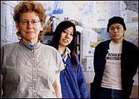
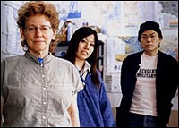
Wendy Brawer with two Green Map
System staffers.
Photo: Paper Sky.
It all started with a map of New York City. With U.N. delegates swarming in for several weeks of preparation for the 1992 Rio Earth Summit, Brawer wanted to find a way to highlight the city’s eco-features. Pooling their experience, she and her coworkers came up with 143 sites, ranging from community gardens to bike paths to green buildings — “even the toxic hotspots of the Big Apple.” The resulting “Green Apple Map” was a hit, and by the time the fourth edition came out eight years later, it contained more than 1,000 points of interest.
As activists in other cities got wind of the project, they wanted in. Using the original map as a template, Brawer and an international group of designers created a set of open-source tools and icons in 1995. Since then, locals in 46 countries have started more than 330 related projects to create their own green maps, and student groups have also gotten involved.
The maps are about bringing people closer to the natural world, Brawer explains, and showing them just how much is happening, ecologically speaking, right in their own neighborhoods. The resources have also proved to be invaluable tools for researchers, students, and conservation advocates by documenting features like hazardous waste sites and sources of pollution.

The stuff of legends.
For its fifth edition, the Green Apple Map has gone a new route, focusing on energy for the first time. The “Powerful Green Map of New York,” released in February, illustrates the city’s energy footprint, with icons for energy impacts, conservation projects, and renewable resources. Brawer hopes the enthusiasm and new ideas surrounding the flagship project will continue to filter down to green maps in other areas. She recently took some time away from her work to speak with Grist by phone about Green Map System and its role as an ecological information source.
So how did the whole Green Map System get started?
The idea, I guess, originally came from helping visitors find signs of progress toward sustainability in New York. But it turned out it was equally engaging for longtime residents as well as newcomers — to see the city in a new way, to connect with the green sites and start using them on a regular basis.
And it all grew out of the Green Apple Map that you created back in 1992?
That’s right. In ’95, we worked with a group of folks from around the world to create a global symbol system, a set of icons that are the same on every green map, so we can cross cultural and language barriers and connect with the kind of sites we’re most interested in. And that’s supposedly the only global symbol system for maps in the world. So that it’s about sustainability is very important.
Where are things now?
There are 236 maps published now and 70 or so of those are online, so there have been something like 3 million maps printed so far. We’re just now publishing 100,000 of the Powerful Green Map of New York, and we imagine that they’ll all be distributed within a year. We’re also looking as a network for options for creating more interactive maps, and right now we’re testing using Google maps for our interface.
One of the things we’re looking at here is, “Who’s not being invited into the conservation challenge locally?” Trying to make sure that all New Yorkers feel like they’re a part of it. Our new website already has up energy- and environment-related information in Chinese and Spanish.
Who uses these maps?
They’re appealing to a wide variety of users — citizens, students, people who’ve been around a long time, people just getting to town. Here in New York, we’ve given them to everybody from hospices and returning prisoner programs to botanical centers, libraries, community centers, and religious organizations.
So you aren’t just focusing on tourists?
Oh, no. People who’ve been in a city a long time don’t necessarily know what’s going on across the tracks. And, you know, many of us are having these “aha” moments, these eureka moments when we suddenly realize that greener living means better quality of living — it’s good for the individual and it’s good for the community and it’s good for the earth.
I know New York is your territory, but who’s creating all of these maps around the world?
This also varies widely: registered mapmakers, it can be a university course, it can be younger students. Oftentimes, though, it is a small group, a not-for-profit, usually in the environmental or planning fields. So there are lots of variations and audiences.
More than a decade into this, is the Green Map System living up to your goals?
I think so. The goal has really always been to connect people with their hometown environment in an engaged way, not in a passive way. So, hopefully, out of it people will find ways to volunteer and get involved, or they’ll realize they don’t have to go very far to experience nature. It can become part of their everyday life. And at the same time encourage them to make choices for their communities that are better for the environment. I guess it’s about seeing yourself as part of nature, especially local nature — the nature that surrounds us every day.


