Steve Carter-Lovejoy is the natural heritage information manager for the Virginia Department of Conservation and Recreation.

Monday, 2 Dec 2002
RICHMOND, Va.
Hello, I’m from the government, and I’m here to help you. No, really! I’m a faithful reader of Grist’s diary feature, but I’ve never seen an entry by a “typical” employee of a state or federal environmental agency. I’m glad to have a chance to describe my work and the work of my colleagues.
As a civil servant for an environmental agency in the Commonwealth of Virginia, I’m like thousands of hard-working, dedicated, even passionate state and federal employees nationwide; I know that the government is lumbering and often reactionary, but ultimately it is a powerful force for positive environmental change. State and federal agencies take plenty of potshots on these pages, but they are key partners with citizens and citizen groups in facilitating environmental progress.
I am the information manager for the Virginia Natural Heritage Program, which is a division of Virginia’s Department of Conservation and Recreation. The division is responsible for “conserving Virginia’s biodiversity through inventory, protection, and stewardship.” Similar natural heritage programs are found in every state and most Canadian provinces, but the Virginia Natural Heritage Program is one of the largest and most successful, with a broader scope of responsibilities than most.
Virginia possesses an extremely rich natural heritage. The book Precious Heritage: The Status of Biodiversity in the United States identifies a biodiversity hotspot in the southern Appalachians of southwestern Virginia. Unfortunately, 20 percent of Virginia’s species are of state conservation concern, with a third of these globally significant. The Natural Heritage Program works to protect Virginia’s natural heritage resources — rare plants and animals, rare or exemplary natural communities, and significant caves and karst features. Virginia’s karstlands are characterized by caves and sinkholes created by groundwater dissolving limestone bedrock. Over 4,000 known caves contain rare bats and a number of globally rare endemic invertebrates.
Our 12 inventory biologists, some of the best field biologists in the state, are responsible for determining the rarity of Virginia’s plants and animals and finding and documenting the location and condition of the rarest. We monitor 1,639 elements, and have documented almost 10,000 locations for these rare species and significant communities and caves. We also have six protection biologists who work with public and private landowners to inform them about the special resources on their property and determine ways to protect these resources. The strongest protection tool is a form of conservation easement called natural area dedication. VDCR is responsible for Virginia’s Natural Area Preserve System, and we now have over 26,000 acres in 36 dedicated Natural Area Preserves.
Placing land harboring natural heritage resources in protective ownership is not enough to ensure the success of these resources; we also need to restore and maintain the ecological conditions necessary for the sustained success of these resources. The 14 staff members in the stewardship section have a remarkably broad range of expertise and skills, which they bring to bear on managing Natural Area Preserve lands and cooperating with other landowners and conservation partners to promote such tools as prescribed burns, hydrological modifications, and invasive-species control.
At the hub of all this activity is the information management section, which I manage. The seven full-time and six part-time IM staff are responsible for assembling data into a central database and facilitating its use by our own staff as well as by other agencies, private organizations, and citizens for research, education, and protection. Our information is key to identifying biodiversity-protection needs and priorities and plays an important role in guiding development around significant natural habitats.
Tuesday, 3 Dec 2002
RICHMOND, Va.
Annual goals are easy to lose sight of while swimming upstream against a continuing flow of short-term crises. State-mandated Employee Work Plans can help, because they are a useful tool for managers to use in setting performance targets with employees, but they make staff groan — mostly because they’re tied to an annual evaluation process. Formal evaluations are a good tool on paper, but without performance-based raises, they’re all stick and no carrot. Virginia’s state employees haven’t had even a cost-of-living raise in several years, and given the state’s current severe budget crisis we don’t expect one for a while.
But still, the paperwork must be done. I’m directly responsible for three Employee Work Plans, but it’s not such an onerous chore because the three people in question are excellent workers with ambitious plans and interesting tasks.
Joe Weber, one of our project managers, will primarily focus on the Virginia Conservation Lands Assessment, though he will also spend some time developing geographic information systems (GIS) data and maps for the distribution of the invasive grass Phragmites australis on the Eastern Shore and for the distribution of seasonal wetlands in the Manassas National Battlefield Park. GIS is a computer system capable of capturing, organizing, analyzing, and displaying geographically-referenced information. Examples of GIS products include maps of natural area preserves and conservation sites, identification of high-potential habitat for inventory, analysis of potential impacts to natural heritage resources of a new highway corridor, and design of conservation sites and interconnecting habitat corridors.

A map of natural heritage resource locations around Back Bay in southeastern Virginia.
The Virginia Conservation Lands Assessment (VCLA) is a wonderful use of GIS to model, map, and prioritize conservation lands in Virginia. Starting with a satellite-based land cover for Virginia, and folding in scores of other geographic data that help characterize ecological significance and risk from development, the VCLA will identify and prioritize hubs — relatively unfragmented natural habitats — as well as corridors that can connect and support these hubs. Our goal is to create a tool that can direct land protection and acquisition toward the highest biodiversity priorities while maximizing the achievement of additional conservation goals for recreation, greenways, and historic/cultural resources.
Megan Rollins, our database manager, directs data management staff and is overseeing some dramatic changes in how we deal with data. We recently implemented Biotics, a new GIS-based application that interfaces with our traditional text-based database. Now, instead of putting dots on paper maps to represent natural heritage resource locations, we can trace the exact extent of a population occurrence on a computer screen, against a digital topographic or aerial photograph background. Using GIS software, we can display natural heritage resource locations however we need to, at various scales and in conjunction with other spatial data, and print whatever customized maps we need.
It’s been a lot of work getting to this point, though — not just for data-entry folks, but also for field staff, who now use global positioning systems and are learning to get comfortable with GIS. Though new data are entered in GIS, we have a big backlog of manually-mapped data that needs to be converted to GIS. One of Megan’s principal roles in the coming year will be to prioritize and facilitate this conversion. She’ll also continue to develop our GIS infrastructure so that VDCR staff can take advantage of our digital datasets for more sophisticated analyses. Perhaps her biggest responsibility will be to move forward with the next phase of implementing Biotics, replacing our 1970s-era database with a new system that will allow seamless integration of GIS data.
Megan and Rene Hypes, the project review coordinator, and I are meeting at 10 a.m. with a programmer from VDCR’s Information Systems unit. She has been helping us design a new database to track project review information — information about development projects that are sent to us for our review regarding potential impacts to natural heritage resources, and our responses and recommendations. Tomorrow I’ll talk more about this, and about the work Rene’s unit does to guide development away from negative impacts to natural heritage resources.
Wednesday, 4 Dec 2002
RICHMOND, Va.
That upgrade to Biotics that I mentioned yesterday? In this morning’s email I learned that NatureServe just scheduled its installation for next week, and that before then we’ll have to upgrade the software on our server. That means we’ll have to scramble to check licenses, contact customer support (always an adventure), determine what is the bare minimum our server needs, and figure out how to squeeze money for the upgrades from our severely constricted budget.
The Nature Conservancy originally set up and supported the international network of natural heritage programs, of which there are now over 75. In 1999, NatureServe was spun off as an independent nonprofit to support and enhance the natural heritage network and to provide knowledge to protect biodiversity. (Check out their dynamite Explorer webtool for conservation information on over 50,000 plants, animals, and communities.) The Virginia Natural Heritage Program is a charter member of NatureServe, and we’ve been one of its pilot programs for implementing new information-management technologies. Working on the cutting edge is exciting, but scary, too!
Yesterday I helped review the latest edition of the database we’re developing to track information for the project review section. Information on natural heritage resources doesn’t do any good unless someone’s using it, and project review is a critical function for us. We review over 3,000 projects per year from across the state, checking to see if they are likely to have any impact on documented natural heritage resources and making recommendations for avoidance or mitigation if they might. Keeping track of all the information is a big job, and we think this new database will make that job easier.
Our project review clients represent a broad range of needs — teachers and students seeking environmental education materials, private landowners wanting to know what’s on their land, academic researchers, localities that want to direct growth away from sensitive areas, and state and federal agencies. Our biggest client is the Virginia Department of Transportation. Though the sheer scale of the road network across the state makes VDOT the largest single threat to Virginia’s biodiversity, we have a positive relationship with them; they are helping to fund our data-development work, and they are reasonably responsive to our recommendations.

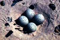
Eggs-tra attention for rare species.
Our next largest category of clients is environmental regulatory agencies. The U.S. Fish and Wildlife Service, the U.S. Army Corps of Engineers, and the Virginia Department of Environmental Quality all use our data to help determine whether, and with what conditions, to issue wetland-development permits and approve other activities that require federal review. We are not a regulatory program; we cannot tell anyone what to do. But our data and recommendations are respected and used by regulatory agencies, so we really get the best of both worlds. We are part of the regulatory process, but we just recommend; others make the hard decisions to require or ignore our recommendations. As a non-regulatory agency, we can more easily gain the trust necessary to help landowners provide appropriate protection and stewardship for their rare species and communities. And developers and their consultants, knowing that regulatory agencies have our data, voluntarily approach us for information so they can incorporate our recommendations into their plans before those plans are submitted for permits and approvals — better planning, fewer costly “train wrecks.”
There’s a tricky balancing act that goes into deciding just how to release information on rare species. People can’t look out for what they don’t know, but providing location information puts species at risk — and not just from malicious vandals, but also from nature lovers who, in their interest to observe might trample a small-whorled pogonia or a piping plover nest. Landowners have every right to know what’s on their property; we also provide as much locational information as is necessary in our project review responses to allow developers to minimize their impacts. For others, Virginia has a progressive exception in its Freedom of Information Act that allows us to protect sensitive information about natural heritage resources, so we can make decisions in the best interest of the resource.

A rare sight.
In the last two years, we have created a new GIS coverage: conservation sites. Conservation sites are areas that include one or more natural heritage resources and the additional habitat necessary to support them. They are drawn from ecological needs, not from property or political boundaries. We have now drawn almost 2,000 sites that incorporate all documented and currently extant natural heritage resource occurrences in Virginia. By focusing on the land instead of on rare species, we provide a data coverage that is not as sensitive as the exact locations of these rare species. We are working to make this information widely available as a tool for screening projects, so that agencies, localities, and developers can do their own project review, only sending us those projects that overlap with conservation sites so that we can provide more detailed recommendations. Then we can focus our limited resources on those projects with likely impacts on rare species, saving us from spending lots of time on the majority of projects that won’t have any impact.
I’ve used my allotted words, and a party beckons. We’ve grown from a small program with about 15 staff in one office supporting six natural area preserves to 50-plus employees scattered around the state supporting 36 preserves. Remaining a focused, integrated agency is a challenge that we address in part with monthly all-staff meetings and (today) holiday parties. It’s always fun to collect stories from the field!
Thursday, 5 Dec 2002
RICHMOND, Va.
Today I’m writing from home, frozen out of work by the winter’s first snowstorm. As a native New Englander, I scoff at the wimpiness (not to say incompetence) of Virginia drivers in the face of snow and ice, but I’m not about to pass up a day off!
We had a great luncheon party yesterday — lots of good food and good company. I chuckled when our support tech/den mother Faye McKinney eyed a table groaning with desserts and remarked on how she never has to resort to sign-ups to get the right proportion of lunch items. After a suitable period of stuffing ourselves, we cleared the conference table of food and had our meeting.
We heard a report from the six of our staff members who were able to attend a meeting of Northeastern heritage programs held last month in New Jersey. We would have liked to have sent more people, but with the budget crisis we could only send as many as could be covered by the expense account provided by NatureServe. It was apparently a great meeting, with about 150 heritage scientists from Virginia to Canada in attendance. As is typical at these meetings, most of the learning took place through interaction rather than presentation. Lots of energy went into discussions about standards — for classifying vegetation communities, assessing quality of populations, defining the degree of uncertainty in locating the extent of a rare species occurrence, and so forth. One of the strengths of the natural heritage network is our ability to discuss biodiversity in quantitative terms, so that “rarity” means the same thing from one state or country to another, and so that NatureServe can incorporate data collected by individual states to produce scientifically-defensible products to contribute to regional and national-level decision-making.
Our crew brought back awards for those who couldn’t attend — lots of awards for 10 years of service in the heritage network (I got one); a few for 15 years; and awards (and lots of kudos) for the 20 years put in by our director, Tom Smith, and the 25 years by Protection Manager Larry Smith (no relation). In his 12 or so years in Virginia, Tom has done a remarkable job leading the Virginia Natural Heritage Program to its current stature, and also played an important role in the creation of NatureServe; Larry has been the main man in the growth of our Natural Area Preserve System. It’s great to look around the room and see the talent and expertise represented in our program, attracted from across the country; it’d be a shame to see further budget cuts whittle away at this treasure.

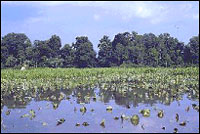
A marsh where Aeshynomene virginica is found.
Two stewardship biologists, Sandra Erdle and Kevin Heffernan, presented their Biological Assessment for work proposed by the National Park Service for the 400th anniversary of the founding of Jamestown in 1607. In the middle of the planned work are two species listed federally as threatened: the sensitive joint vetch, Aeshynomene virginica, and the bald eagle, Haliaeetus leucocephalus. VNHP’s inventory and research elaborated the concerns but also identified factors that allowed NPS to come up with alternatives to let the celebration go on without harming either species. And we heard that NPS plans to use this Biological Assessment as a model for other Environmental Impact Statements around the country.
Kevin and Sandra, as well as eight other full-time and 10 part-time staff, are funded by “soft money” — grants and contracts from sources other than the state funding received by the Department of Conservation and Recreation. Funding comes from lots of federal agencies, conservation organizations, and private businesses and consultants, for natural heritage resource inventories, protection and management recommendations, project review, data development and distribution, and vegetation mapping and classification. In 14 years as a program, we’ve produced hundreds of valuable technical reports, and our entrepreneurial efforts have contributed hundreds of thousands of dollars of soft money to support valuable staff who have considerably extended the work of our agency. One of the most important jobs we section managers have is to identify and secure the grants and contracts necessary to retain our quality staff, but we’ve always made sure that the work we contract to do for external funding helps achieve our mission of protecting Virginia’s biodiversity. Unfortunately this leverage will be disproportionately reduced as the budget ax falls, since we’ll have considerably reduced ability to secure and administer new grants and contracts.
Our entrepreneurship extends to augmenting funds provided by Virginia for buying conservation lands. We’ve built the current Natural Area Preserve System mostly from $11 million in bonds approved by voters in 1992, but lots of hustle (mostly from Larry Smith) augmented that money with over $4 million from other sources. That money’s gone now. Virginia is dead last in the region for money devoted to conservation land acquisition. We’re excited about new bond funds approved by last year’s General Assembly and by the voters last month (though apprehensive too — it takes staff resources to spend money wisely, and it will take even more resources to effectively manage the lands we buy). But Virginia’s rapid growth puts tremendous pressure on our lands and on biodiversity. We badly need a permanent source of funding for conservation.
So this is a tough time to have a budget crisis. (Is there ever a good time?) Virginia’s new governor, Mark Warner, is supportive of environmental concerns, but he’s inherited a real budgetary mess. Still, the total of all of the state’s environmental expenditures is less than 1 percent of the budget. I sure hope we can do better than that.
Friday, 6 Dec 2002
RICHMOND, Va.
Back to work after a snow day yesterday. I’m jumping right into scheduling software purchases and installations for early next week, so we can get the Biotics 4 upgrade installed late next week; it looks like it will all pull together somehow, oh boy. Then it’ll be time for more questions about our future priorities.
Our conservation sites coverage goes a long way toward adequately representing lands associated with documented natural heritage resources — but what about the 98 percent of the state that hasn’t been closely inventoried for rare species and exemplary communities? Conservation Planner David Boyd is overlaying geology, soils, and land use coverages with digital aerial photography and using GIS to identify areas of suitable habitat for plants associated with an unusual geologic substrate in four counties of northern Virginia. This is the first of what we hope will be a number of GIS coverages identifying those lands with a high potential for containing specific rare species. But these coverages heighten the need for a “negative data” coverage — inventoried land areas where we’re sure that rare species do not occur. So many databases, so little (staff) time!

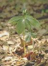
Talinum mengesii.
There’s so many species we’ll never know about — an estimated 35,000 invertebrates in Virginia, for instance. A few groups are relatively well-known (butterflies, dragonflies, mussels) and we’re trying to extend knowledge in some groups (moths, cave invertebrates) but we’ll never know the distribution of invertebrates as well as we know the distribution of birds. To protect biodiversity we can’t identify, we call on the concept of “coarse filters.” By identifying and protecting excellent examples of all natural community types, we can presume that we’ve protected most of the organisms associated with those communities. The success of this strategy requires a comprehensive classification of natural communities in Virginia, and we have a strong unit of five ecologists working on this. Community types are not as discrete as species, and almost all of Virginia’s landscape has been influenced by human impacts, but we see this challenging work as critical to protecting all of Virginia’s biodiversity.
It’s probably apparent through what I’ve written this week that I’m very proud of the Virginia Natural Heritage Program and pleased to be associated with its work. There are several keys to our effectiveness. One is our focus: We’re all committed environmentalists, but we filter all activities through our mission, and we don’t take on responsibilities that don’t directly apply to our goal of protecting biodiversity. Thus I might be personally appalled at the land gobbled up by a large subdivision with a golf course, but if this project is submitted for our review, I won’t comment if it won’t impact the natural heritage resources that we monitor. This protects our credibility by keeping us out of fights to which we don’t have specific scientific knowledge to contribute.
At the same time, we can take strong stands on natural heritage resource issues and rarely have to back down from them, because “facts is facts.” It helps that we’re not a regulatory agency. Compromises do need to be made in government, to adequately serve the myriad competing interests of the public, but as an independent presenter of scientific data, we can keep the facts on the table in situations when a regulatory agency, needing to compromise for quite legitimate reasons, might try to downplay data to make its compromise stance more comfortable.
Partnerships are a real key to our efficacy and credibility is key to our ability to form successful partnerships. “Rabid” advocacy groups and “cold-blooded” developers alike seek our data. We have developed many specific partnerships, often sealed by bureaucratic-sounding “Memoranda of Agreement” or “Memoranda of Understanding,” with state and federal agencies, land trusts, and conservation organizations, that allow us to extend our knowledge and our influence. We partner to gain funding, to gain natural heritage resources data, and to support activities that will result in improved protection and management of natural heritage resources.
In my experience, people want to do the right thing. Building a solid scientific knowledge base and delivering that knowledge to the right people at the right times can help to make sure the right things get done.

